PULAU UBIN, SINGAPORE

WELCOME TO HISTORYThis is a quick look at the unique little island just off the coast of Singapore, a national park established to preserve Kampong life as it was in the 1960’s. We spent a day exploring some of the trails by bicycle when we lived in Singapore. These were taken in October 2009.

Pulau Ubin, SP-1-2
Departure Point at Changi Jetty
Pulau Ubin, SP-1
Bums Onboard the Bumboat

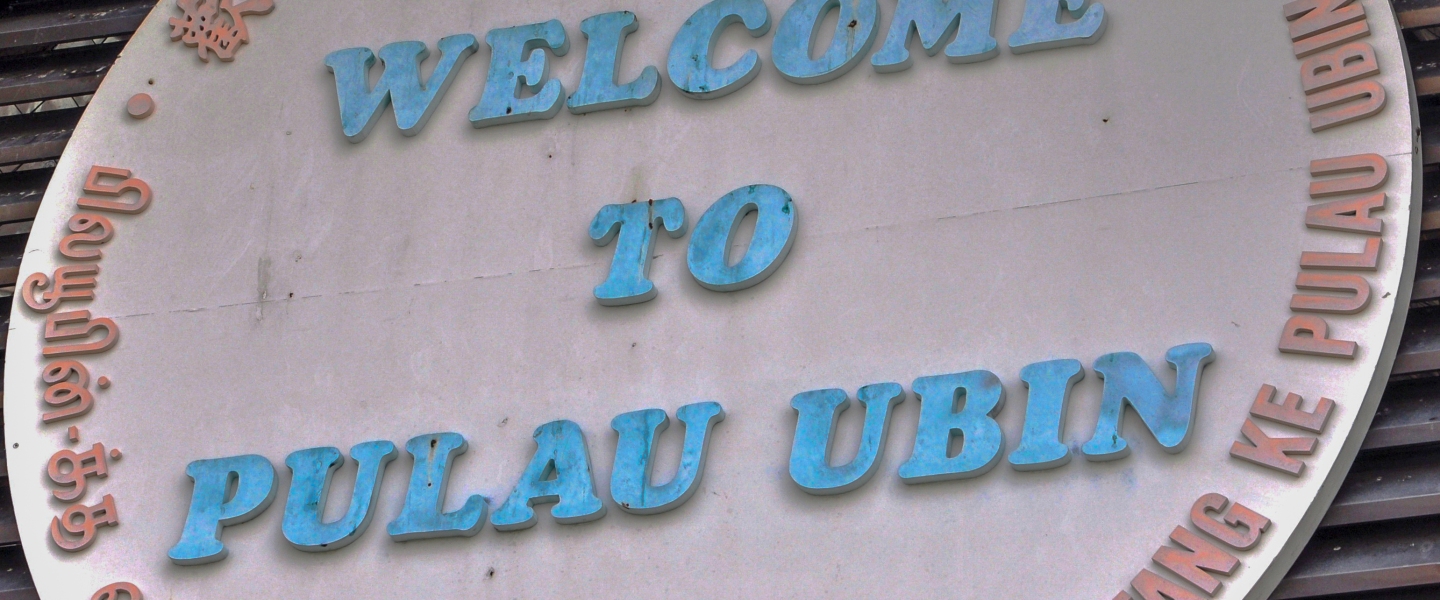
Kari and some very polite young students settle into their seats for the ten minute ride from Changi to the jetty at Pulau Ubin. “Pulau Ubin” means “Granite Island” in Malay – I believe “ubin” means “island” but I could be wrong so don’t quote me.

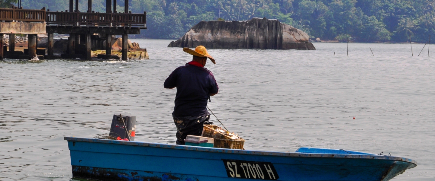
The small boats used around Singapore are called “bumboats” – a term handed down by the Dutch for the wooden canoes used to ferry goods and people between large ships and the harbour.  The Dutch word for canoe is “boomshuit”. Shorten that to “boom” and add “boat” and you get “bumboat”. Apparently.

Pulau Ubin, SP-3
Fast Bumboat
Pulau Ubin, SP-4
Passenger Bumboat AKA Ferry

Although it was a typically hot day around 33C with humidity around 90% the operator of our boat wore a colourful knitted cap that added to his mystique, if not his charm. Note the umbrella handles hanging from the back of his seat; in this part of the world we all carried or had access to big umbrellas.  When we first arrived we started with the little fold-up units that slipped neatly into handbags or briefcases, but after the third walk in a torrential downpour we quickly replaced them for the largest black brollys we could find.

Pulau Ubin, SP-2
Ferry Operator

I have read that fishing off Pulau Ubin produces “30% fish and 70% rubbish”; – not sure that the rubbish might include, probably better not to know – but the fish could be Red Snapper or Catfish.

Pulau Ubin, SP-5
Snapper or Rubbish?

Pulau Ubin, SP-7

So why go to Pulau Ubin? Mainly for a chance to get away from the crush of people and rush of cars that dominate the city.  This four square mile island, a collection of five smaller ones connected together when the dividing rivers were dammed for prawn farming, was originally a source of granite, rubber, coconut and pineapple for the people of Singapore.

Pulau Ubin, SP-8
Bicycle Alley

There are many trails on the island and very few vehicles so it’s a great place to meander far, far from the maddening crowds. Well much fewer people than on the mainland. Bicycle rentals are inexpensive and the bikes adequate for the gentle cyclist.

Pulau Ubin, SP-13
Comfortable Riding

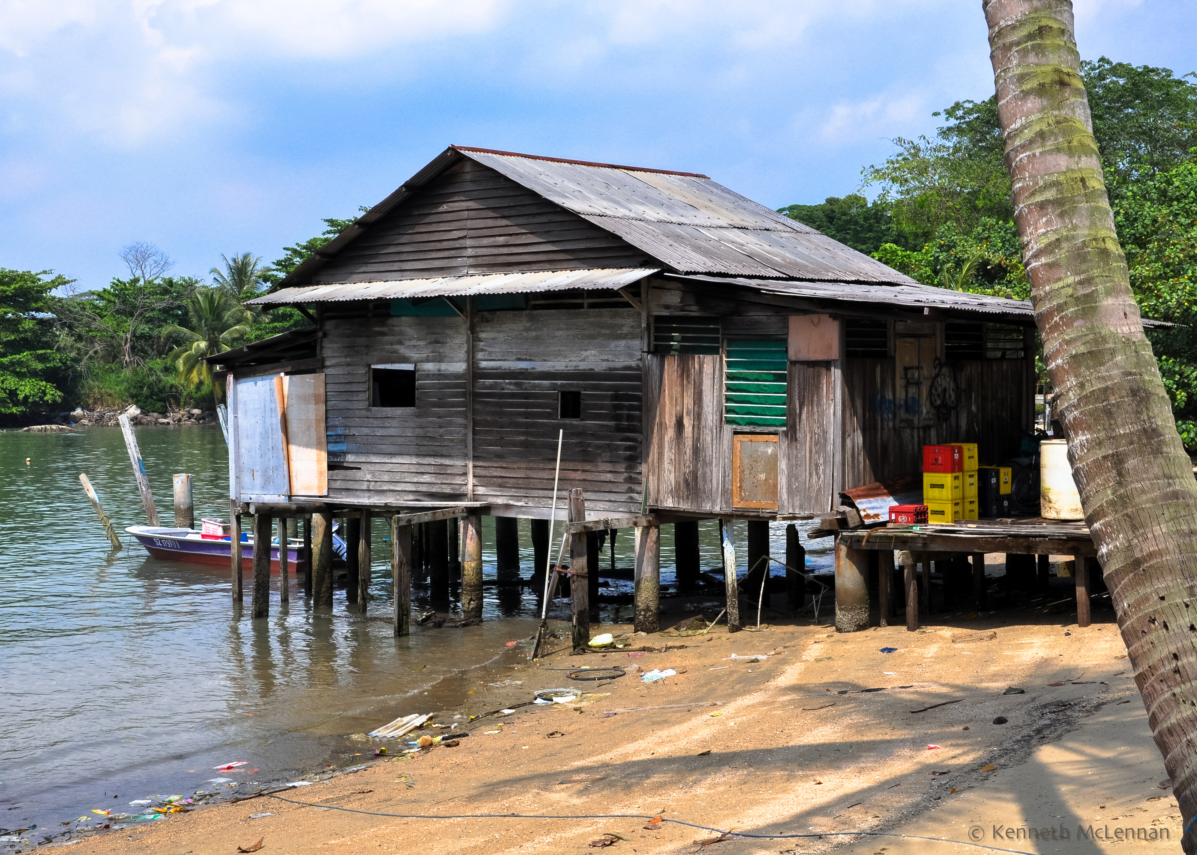
The Kampong-Style stilt house was very common along the water’s edge of Singapore through to the 1960’s. Many are still used in Malaysia and Indonesia but in Singapore they are found on this island as a reminder of the early days of development.

Pulau Ubin, SP-9
Kampong-Style Stilt House
Pulau Ubin, SP-10
Tide’s Out
Pulau Ubin, SP-25
Tide’s In

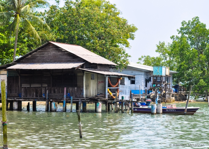
The last few photos show the Stilt-House and Jetty when the tide is out and when it’s back in again. The jetty from the house makes it easy to access the boat. Like having an attached garage in Canada.

Pulau Ubin, SP-11
Top of the Trail

After a bit of uphill riding we reached the top of the trail where we took a break and checked out the view. We saw many heads popping up and down over the tall grasses as people cycled by on distant trails, young people with fishing rods and older folks with hats jammed low over their eyes. In a fit of exuberance (dangerous), I decided to ride down and across  open ground to a lower trail only to have the front wheel disappear into a hole. My ride was cut short as I tumbled over the handlebars and landed face down on the ground. Winded, sore, scratched and bruised – but otherwise fine.

Pulau Ubin, SP-12
Water Skiing & Mangroves

From the top of the trail we looked east towards the even smaller Ketam Island and were surprised to see a boat skimming down the narrow channel with a water skier flying along in its wake, a jarring contrast to the slow and quiet day we had been enjoying.

Although we only saw one cemetery on our ride we have since discovered that there are a total of three.The largest is close to the Ho Man Choo Granite Quarry with seventy burial sites. There is one behind the current police station and the one in the photos I believe is the Kg Bukit Coffee Chinese Cemetery and contains thirty five Cantonese. There are also three Malay cemeteries which we did not see.

Pulau Ubin, SP-14

Pulau Ubin, SP-15

Chinese settled here in the mid 1800’s in order to quarry granite. The government established more quarries in the 1850’s, using convicts to work the pits. The granite from Pulau Ubin was used in many of the early building projects including lighthouses (Horsburgh – 1851; Raffles – 1855)  the Causeway, some of the reservoirs, the Singapore Harbour as well as in Fort Canning and Fort Fullerton.

Pulau Ubin, SP-16
Not Lost
Pulau Ubin, SP-17
Safer Than Cross-country Biking

There are restaurants down by the jetty but we didn’t find much once we started exploring. Luckily there is a food-truck which brings food out to the trails. We came across it just at the right time for a quick break of cool coconut water.


Pulau Ubin, SP-20

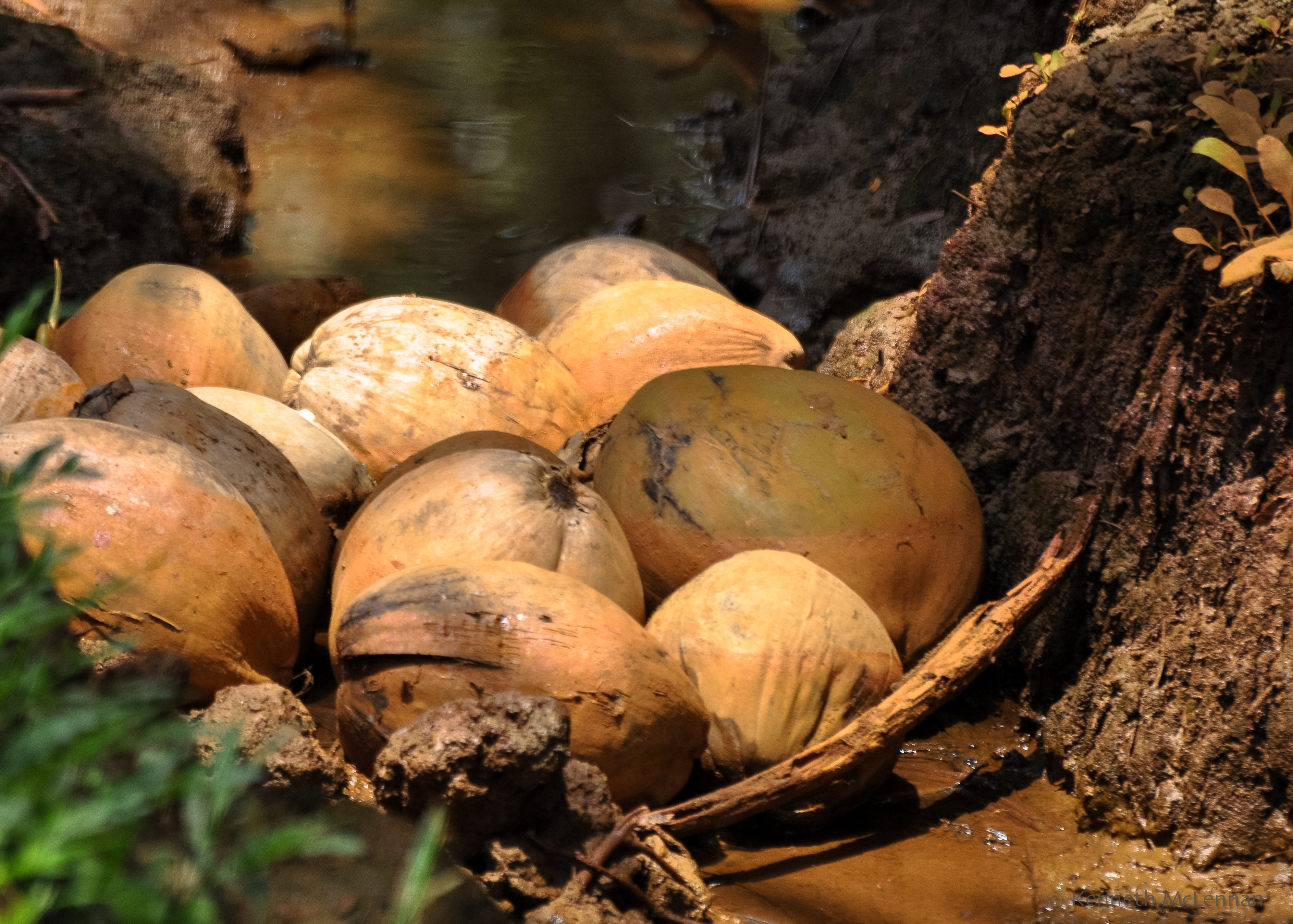
I think the bright green makes a nice contrast to the red soil.

Pulau Ubin, SP-18

Pulau Ubin, SP-19

This looks like it could be a picture of some spicy Singaporean noodle soup – but it isn’t. The soil is very rich in minerals and when it rains the mud becomes this reddish brown shade.

Pulau Ubin, SP-22

We saw many coconuts in various stages of ripeness lying on the ground and in the ditch. Coconuts here are as common as apples are for us in B.C. I think I’d rather be hit by a falling apple than by a falling coconut!

Pulau Ubin, SP-21
Turtle Head Soup

This was a surprise! While looking for my next photo this guy popped his head out of the murky water. I wouldn’t have believed anything could actually live in such rust coloured sediment but apparently turtles can…

Pulau Ubin, SP-23

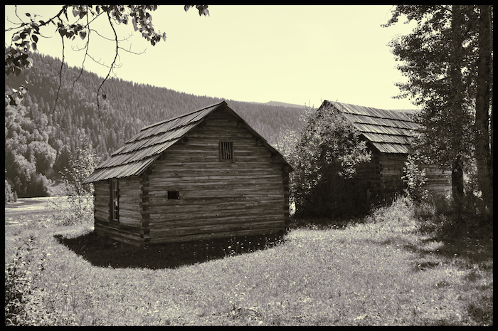
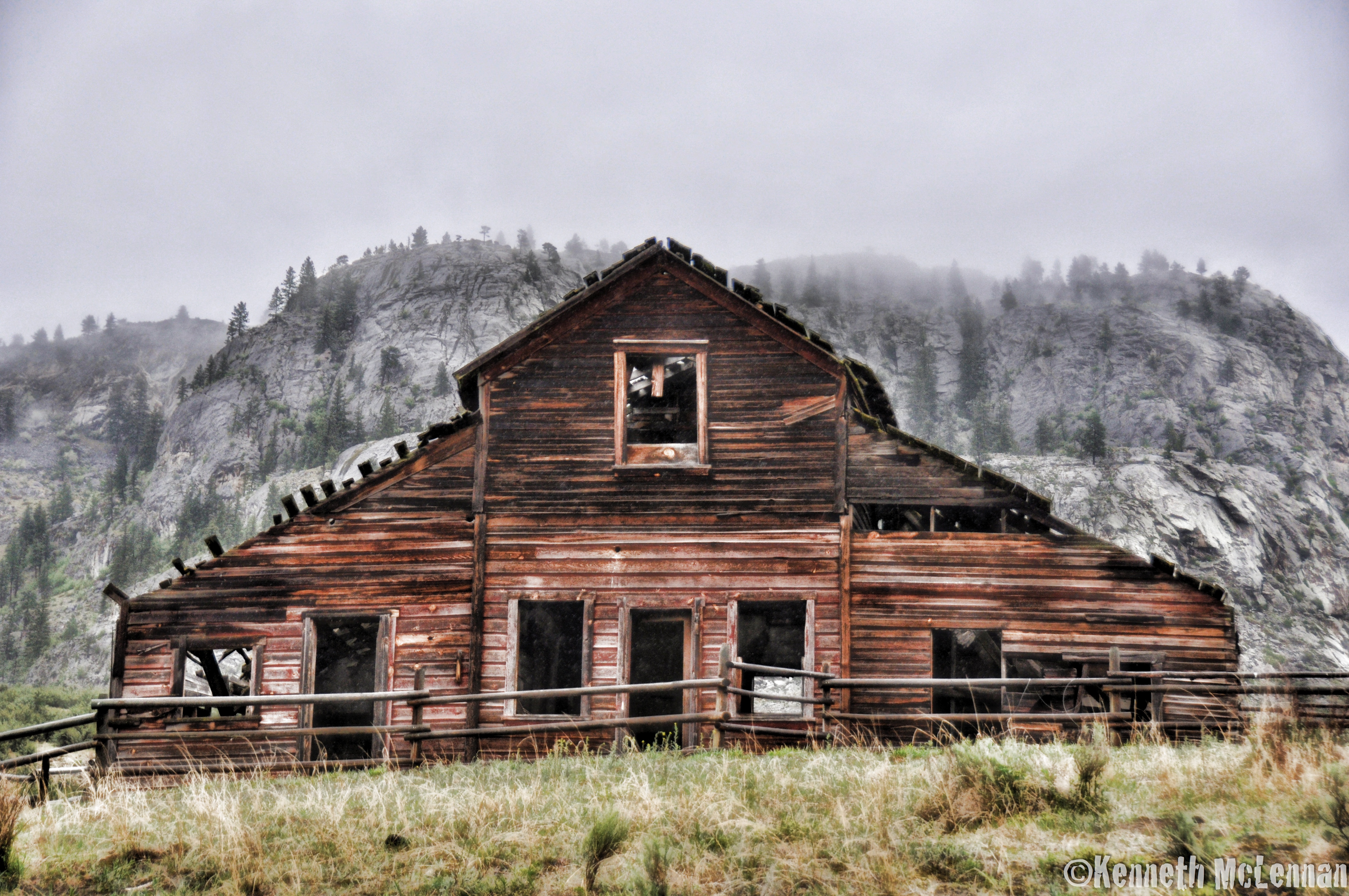
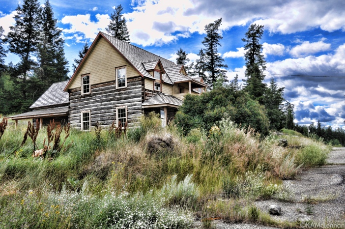
Bumped into this guy while trying to push through the plants to get a closer picture of the abandoned building in the photo below. There are remnants of the original Kampong scattered through the area. The vegetation is slowly taking them back and soon there will be very little left to suggest they were ever here.

Pulau Ubin, SP-24

Thankfully the Singapore Government has set the island aside as a recreational area so there’s a chance that the history will be protected. Most of the island is managed by National Parks, and according to them then get about 300,000 visitors every year.

Pulau Ubin, SP-1-3

Well worth the visit – somewhere to go back to whenever an escape from the city is necessary.

B-17G FLYING FORTRESS

B-17 Flying Fortress-40
“Wings of Freedom Tour” Moffett Field, CA

When we were visiting friends in the Bay Area of California the “Wings of Freedom Tour” appeared at nearby Moffett Field on one of their many scheduled shows this year. It was a bright, breezy day perfect for wandering around the tarmac and poking cameras into and around the four vintage fighter planes from WW II. Besides the B-17 Fortress there was also a B-24 Liberator bomber, a B-25 Mitchell bomber and a TP-51C Mustang fighter plane.

B-24J Liberator-1
B-24J Liberator
B-25 Mitchell-1
B-25 Mitchell
TP-51C Mustang-1
North American TP-51C Mustang

I ended up spending most of my time taking photographs of the B-17 Flying Fortress.  The “Wings of Freedom Tour” allows visitors to walk out onto the apron to explore the exteriors and interiors of the bombers. For an extra fee they will also take passengers on a 30 minute flight.

As I was wandering around the plane I noticed a petite lady in a ball cap and pink jacket heading past the tail of the aircraft pulling a small black carry-on rolling bag.  She stopped by the steps of the rear door, parked the bag and pulled out a small white towel.  I politely asked what her role was on the team, to which she replied “copilot on this tour”.

This lovely lady introduced herself to me as Mary and explained that she has been flying for close to 40 years and is certified on everything from small single engines to jets. In fact she works for the FAA as someone who certifies other pilots.

B-17 Flying Fortress-21
Co-Pilot of “Nine-O-Nine” – Mary

I did not get to meet the other crew member and pilot, but he looked just as you would expect the pilot of a vintage warbird to appear.  White hair blowing in the wind, big mustache, tanned face and aviator glasses.  When it came time to prepare the plane for flight he drafted me (in the green shirt and tan cap) and another to help turn the engines over (for compression?) by pulling on the propellers.  It’s a lot harder than I would have imagined.

The Flying Fortress has four 1200 HP Wright-Cyclone engines that can pull the plane up to a maximum of 250 miles an hour with a maximum range of 2400 miles. (Not sure if it can make 2400 miles when flying at maximum speed!).

The wingspan is 103′ 9.3″ and the plane is 74′ 9″ long.  There were 12,731 of this particular design built. The prototype of the series was introduced in 1935 at Boeing Field, South Seattle, WA and the first B-17 went into combat in 1941 as a British RAF high altitude bomber. The later models came with modified tails that were enormous, designed to provide better stability and control, specifically for aiming bombs from far above the target.

B-17 Flying Fortress-22
B-17G Distinctive Tail

The front of the bomber sports a plexiglass nose for the bombardier and his navigation table, which is behind him. Just below him is a later defensive addition known as the “chin turret”; it comes complete with a lethal set of machine guns.

In the midsection there are two machine gun positions manned by “Waist Gunners”, one on each side slightly offset to give them both room to maneuver in the tight space.

Under the belly of the bomber, stuffed into a “Ball Turret” is another machine gunner lying on his back, legs up, with the machine gun controls between them. This is a very tight space and I can’t imagine what it must have felt like suspended over a target with bomb flashes below you and flack coming towards you.

B-17 Flying Fortress-7
Ball Turret

And finally, at the very rear of the aircraft, tucked into a spot under the huge tail, sits the “Tail Gunner”. This position is considered one of the most important as it provides the  defence from attacking fighters that generally came at the bombers from behind. The gunner sat on his legs in a kneeling position, connected to an oxygen supply and intercon, and ran the twin machines guns poking out of the back of the plane.

B-17 Flying Fortress-8
“Cheyenne” Turret and Tail Guns

Inside and just behind the cockpit lies the bomb bay which can house up to a 4,000 pound load of bombs. The bombardier sat on a seat in the plexiglass nose cone where he had maximum visibility and accuracy sighting his target with the use of a Norden Bombsight (TED Talk). (Take 15 minutes to watch the TED Talk by Malcolm Gladwell) 

One of the great things about being at a Wings of Freedom Tour is that the planes are in full working order and provide the opportunity for enthusiasts to go for a 30 minute flight. The 13 ton Flying Fortress hasn’t been modified for the comfort of the paying passengers – it provides a very realistic utilitarian, cramped, bumpy ride accompanied by the strong smell of aviation fuel and burning rubber.  And it is very noisy.

From the edge of the apron visitors can watch the Fortress lumber down the runway, lurch into the air, make a pass overhead and return half an hour later to drop off and pick up passengers.


A few interesting notes about this particular B-17G

Serial number 44-83575, was built too late to see combat. It was subjected to the effects of 3 different nuclear tests (not sure how that was completed), and then left for 13 years in order for it to dissipate the remnants from the explosion.

It flew for 20 years as a water bomber under the name “Yucca Lady” before being sold to the present owners, The Collings Foundation. Tom Reilly Vintage Aircraft took on the project to restore it back to the original wartime configuration, after which the plane was renamed the “Nine-O-Nine”.

The “Nine-O-Nine” is famous in its own right having made 18 flights to Berlin between February 25, 1944 and April 1945. In those 1,129 hours she dropped 562,000 pounds of bombs and suffered from a lot of flak damage. After the war the plane was flown back to the United States, complete with 600 patched holes!

Links to more information:

Collings Foundation

Boeing B-17 Flying Fortress

Military Factory


CP RAIL SNOW PLOW

The Canadian Pacific Railway was the link that helped bind Canada after the country was formed in 1867. The company was created in 1881 and four years later the railway ran from coast to coast – or at least from Montreal to the West Coast.  The famous ‘last spike’ was hammered into place on November 7th, 1885 at Craigellachie, BC just west of Revelstoke.

This was a great feat all on it’s own – but like our northern highways, maintaining a rail line across the continent during winter is a major challenge. Something many of us never think about – and yet the railways have to be prepared to move tons of snow at short notice any time during the winter.  And to accomplish this the railways maintain a number of snow plows strategically placed across the country, but strangely I could not find much information on the internet about the CP Snow Plows and Spreaders.

bef42-20152b072b142bcp2brail2bsnow2bplow2b25262bspreader252c2bkamloops252c2bbc-11-edit-2-tif

There is a photo of a CP Snow Plow and Spreader sitting in Banff Alberta taken on January 10, 2013 by Chris Moss CP20400762 where he suggests that #20400762 was acquired in 1923.

 Since this is #400648 I wonder if it is even older.

I found one comment that suggests these were built at the Angus Shops in Montreal, Quebec. Click on the link for some fascinating Canadian Rail history.  By the way, the Angus Shops were redeveloped into a residential community over a 10 year period starting in 1984.


Behind the actual Snow Plow is another separate unit called a ‘Spreader’. From what I can gather by looking at various photos and videos this has wings or blades that are pushed out by hydraulic cylinders to move snow away from the tracks after the plow breaks through the drifts.

I did note signs stencilled on the side stating, ” Wings & Plow must be locked in secure position before spreader is moved in track service”. These words came up again in photos of other spreaders.

GHOST TOWN AT QUESNEL FORKS, BC

 Backroads to Likely  Site Map

When in High School my friends and I would drive the backroads from Quesnel, BC heading to Wells, Barkerville to the north west of town or down the Hydraulic Road behind Dragon Lake just south of town. I’d heard about Quesnel Forks but never been there so decided to explore the Likely and Horsefly area this summer.

Getting to Quesnel Forks meant  driving from Likely along a winding gravel road, down a steep set of switchbacks about 11 kilometers west of town to the abandoned townsite of Quesnel Forks.

Backroads to Likely  Left Behind
Last Car in Quesnel Forks

Another resource town long abandoned, Quesnel Forks was first settled in 1860 and served as a supply center for would-be miners heading north to the gold country at Antler, Lightning and Williams Creek closer to Barkerville. This was the best route until a rough road was cut along the Quesnel and Cottonwood Rivers. At that time this community served about 100 permanent residents and 2,000 or more transient prospectors heading into and out of the surrounding gold fields.

Backroads to Likely  Old Bridge at Quesnelle Forks
Photo of a Photo at the Visitor Center shows the original settlement of Quesnel Forks with the Toll Bridge
Backroads to Likely  Old Bridge at Quesnelle Forks
No Bridge Exists Today

From what I’ve read, Quesnel Forks had two bridges to cross the Quesnel River during it’s history – a North Fork and a South Fork bridge. The photo of the sign above, that I took at the visitor center is an ad for Adler and Barry’s Toll Bridge. Looking for information led me to another interesting trail about the Barry and Adler association which you can check out here: Barry and Adler


Backroads to Likely  Old Slide Site
Landslide across from the ghost town

 The footings for the bridges built along the Quesnel River were always threatened by slides and high water but the bridge lasted until 1948 before it was destroyed by a massive spring run-off.

Backroads to Likely  River Bank at Quesnelle Forks
Restored buildings on the bank of the Quesnel River

 The riverfront of the abandoned town used to be a few streets into the current riverbed. When a big slide collapsed on the opposite hillside the resulting wave took out much of the bank.

Backroads to Likely  Riverfront
Restored buildings on the bank of the Quesnel River

Backroads to Likely

Backroads to Likely  Deconstructing  General Store
Remains of the General Store
Backroads to Likely  Fire Bucket
In Case of Fire use Water Bucket and Run Along Roof!
Backroads to Likely  Front Porch
The Necessary Porch
Backroads to Likely  Interior Detail
Interior Details of Abandoned Building

Backroads to Likely

Backroads to Likely

Backroads to Likely  Old TubBackroads to Likely

Backroads to Likely
Shake Roof
Backroads to Likely  Wall Detail
Wall Detail
Backroads to Likely  Shorty Lahaie's Cabin
Leo “Shorty” Lahaie’s Cabin

Who was Leo “Shorty’ Lahaie? Check the link for some interesting chat about Shorty – 

Apparently this tenacious miner was the last to leave town some time in the mid-1950’s.

Backroads to Likely
Two Ghosts Chatting

Backroads to Likely  Miners Cabin

Backroads to Likely  Miners Cabin

Backroads to Likely  Tree-in-House
Birch Tree in Abandoned Building
Backroads to Likely  Grave Markers
Gold Rush Miner

There’s a cemetery at Quesnel Forks (do you know the difference between a Cemetery and a Graveyard?) where some quiet time visiting the markers makes for an interesting history lesson.

Backroads to Likely  Grave Markers
Farmer
Backroads to Likely  Grave Markers
Of Chinese Descent
Backroads to Likely  Grave Markers
From Canton

In the cemetery there are a number of markers to remember the Chinese miners and merchants who made Quesnel Forks their home by the middle of the 1870’s. Many came from the provinces in South China and more came up to make their fortune in the gold fields after leaving the CPR on completion of the line through Ascroft.

So much history every time I check for details!

For example: Smallpox killed some; Mining accidents killed others; and what about the marker that simply says “In Memory of Jewish Merchants…Murdered…” What’s that all about?

Backroads to Likely  Grave Markers
Storekeeper Dies of Smallpox
Backroads to Likely  Grave Markers
Murdered Jewish Merchants
Silver Fox

On leaving, the last visible resident made an appearance – just to remind us that although humans may have abandoned this site there continues to be a healthy population just behind the scenes.

ABANDONED BRIDGE IN THE FRASER CANYON

Old Alexandra Bridge
Salmon Sculpture on the Current Alexandra Bridge

There are so many things to explore in British Columbia, and many sites are not that far off the main highways. For example there is an old bridge hidden in the Fraser Canyon just north of the new Alexandra Bridge. This structure is barely visible from the new bridge itself so I imagine that most travelers don’t even know it exists.  Probably just as well since being ignored in this day and age means not being covered in graffiti and garbage.

Old Alexandra Bridge
Looking at the Old Alexandra Bridge from the Current One

The “old” Alexandra Bridge is on the original Cariboo Trail and was built on the site of the first bridge built in 1861. The first bridge was built by Joseph Trutch who named it after the Princess of Wales and was a toll bridge.  The charge was $7.40 a ton and in 1861 that was a substantial amount of money. 

Old Alexandra Bridge
Supporting Column
Old Alexandra Bridge
Trail on Old Highway

The relic of the second bridge is now part of a Provincial Park rest stop with the old 1920’s highway part of the trail down to the bridge.

I read that the original bridge was dismantled in 1912 – but the replacement wasn’t built until 1926. I had to wonder why. Apparently the Cariboo Road had been abandoned with the construction of the CPR in the 1880’s but when personal vehicles became more popular after the First World War the province starting to invest in new roads, including re-opening one through the Fraser Canyon.

I found this to be a great stop on the 8 hour drive between Vancouver and Quesnel at the end of July. Not sure if I’d like to make the walk from the parking lot to the bridge on a typically hot August day with temperatures soaring into the 40’s. And the park is not open in the winter – too dangerous to have traffic trying to get on and off the highway at this point on icy roads.

Old Alexandra Bridge
Looking from the North Access
Old Alexandra Bridge
Detail of the Bridge Deck – Rivets and Steel
Old Alexandra Bridge
Engineered Art

I was fascinated by the bridge deck itself but trying to find more about the history of this design was a bit of a challenge.  They are called riveted heavy duty steel bridge decks and were one of the first grating types developed in the early 1900’s. There are still quite a few riveted decks that stayed in service for decades, including: Riveted Bridge Gratings

  • The Veterans Memorial Bridge in Bay City Michigan which carries the four lane MI highway 25 over the Saginaw River originally constructed in 1957. the bridge included a new 5” Deep Heavy Duty Riveted Bridge Deck. 
  • The Robert Moses Causeway Southbound Bridge at Captree State Park was built in 1951, and in 2007 the original riveted bridge deck was still in service.
  • The LaSalle St Bridge in Chicago, Illinois with Riveted Bridge Deck installed in 1971 is still in good condition after over 37 years in service. 
  • The Robert Moses Parkway Bridge in Long Island, New York with riveted steel deck installed in 1951 was still in service after 56 years. 

I wonder how they would stand up to the sand and salt used on roads in the winter?

Old Alexandra Bridge
South Approach
Old Alexandra Bridge
Cables Anchored

Back to the Fraser River and the old Alexandra Bridge. The road goes nowhere from the south exit of the bridge, just a faint trail can be seen fading into the trees. The bridge is used by local fishermen since it is a traditional fishing place giving them a good spot to hook Chum, Pink, Sockeye and Coho salmon on their way upstream to spawn.

COPPER MINE, BRITANNIA, BC

Driving between Vancouver and Whistler on the Sea-to-Sky highway I’ve passed the signs to the British Columbia Museum of Mining many times and always wondered what it was all about.

2014 06 14 Britannia Mine
Welcome

In June of 2014 we made a special day trip just to check out the museum and found many interesting mining related artifacts that made me wonder even more.  In todays post I’ll just provide some images from the tour route and then follow up with future posts about some of the things we learned about while wandering around the site.

Warning
Warning

There is a guided underground tour that takes visitors for a short ride down the entrance tunnel of the last remaining mill buildings at Britannia Beach.  There have been three mills here in total, #1 operated from 1905 to 1914, #2 operated from 1914 to 1921 and the one left standing operated from 1923 to 1974.  You’ll have to visit the museum to find out what happened to the first two.

Footings for Mill #2

Before going underground all visitors are required to wear safety hats – not quite as much equipment as the original miners. In this room the miners wet and dirty work clothes are placed in baskets and then hoisted to the rafters where they can dry out.

Clothes Dryer
Clothes Dryer

All aboard for the ride into the heart of the mountain. A copper filled mountain – or used to be anyway. Starting in 1904 and operating through to 1974 these mills combined to produce about 650,000 tons of copper and was once the largest copper mine in the world.  Right here in B.C.!

Into the Dark
Into the Dark
Main Tunnel
Main Tunnel

There are many tunnels but visitors only get to see a few at the surface.  The longest tunnel is 16 km and drop to somewhere close to 650 meters under the level of Howe Sound.  Total tunnels: 210.

How Dark Is It?
How Dark Is It?

When people tell you that it is dark underground – well, it’s really, really dark.  I put my hand up in front of my face and waved it around – not a glimmer.  The first miners had candles. Apparently a team of them got to share ONE candle!  Here’s what it looks like with one candle power underground. Nothing shows up in the background behind the miner – even though there is a mine shaft, rails, mining equipment and a number of other people standing close by.

Ore Carrier
Ore Carrier
The Light of Day
The Light of Day

The end of the tunnel tour brings the visitor out to a trail above the community of Britannia Beach where there is an abandoned ore carrier from a recent era and a view of the plant site.

Core Samples
Core Samples
Core Sample Trays
Core Sample Trays

The gravel trail leads downhill through the sample shed and on to the main doors of Mill #3. This building is over 20 stories high and is built on to the side of the mountain. Not sure how far up the tracks for the sled go – but we were told that people were never allowed to ride it. I think I see one single – thick – but only one cable attached to the sled. Hmm…where would it go if it came loose?

First Floor Mil #3
First Floor Mil #3
View From #3 Main Floor

This is where that sled would go – right through this wall and across the lane into the adjacent workshop.

In a future post I plan to wonder about equipment that I photographed along the way.

HAYNES RANCH, OLIVER, BC

While on a “busman’s” holiday last week the trip lead north from Osoyoos in the British Columbia Okanagan valley through the northern gateway at Sicamous and Shuswap Lake east to Revelstoke at the western entrance of the Kootenay mountain range.

The most interesting photos I came back with are from the what was the Haynes Ranch situated between Osoyoos and Oliver, BC. The property is off the beaten track and the remaining buildings can only be found if you’re looking for them.

Haynes Ranch, Oliver, BC 7

The beginnings of the vast holdings were in 1869 when Haynes and his partner, Lowe recorded the right to purchase what was previously public land. In the end the ranch contained almost 21,000 acres.

Haynes Ranch, Oliver, BC 1

Haynes in this case is  Mr. John Carmichael Haynes, born in Ireland in 1831 arriving in Victoria, BC in 1858. His history sounds like an interesting story for another time.  Highlights include sailing to Victoria via the Panama Canal, serving as a special constable under James Douglas (governor) at Hills Bar, Yale, Rock Creek, and Similkameen where he was to set up a customs station.  From there he went to Osoyoos Lake and on to the Kootenays as justice of the peace – and a number of other  government positions until he returned to Osoyoos Lake in 1872.  The 20,000 plus acres were originally used as a horse ranch but quickly switched to a cattle ranch with a herd close to 4,200 head. John Haynes died in 1888.

Haynes Ranch, Oliver, BC 2

The next Haynes to be involved with the Haynes Ranch was the eldest son of Judge John Haynes and his wife Emily Josephine.  The son, Valentine Carmichael Haynes, was born in 1875 and is recorded to be the  first white child born in Osoyoos. Reference http://osoyoosmuseum.ca/index.php/about-us/history-of-osoyoos/settlement-and-ranching-in-osoyoos/the-first-white-settlers.html?showall=&start=7

Haynes Ranch, Oliver, BC 4

When the Judge died the family returned to Ireland so that the children could finish their education. Val returned to the area in 1893. By then the ranch had been bought by Thomas Ellis so Val went to work for him as foreman.  He retained that position after a company called Shatford Brothers bought out Ellis in 1905 and even after the Shatfords sold the land to the Government in 1919 for use as a Soldiers’ Settlement.

Haynes Ranch, Oliver, BC 6

After checking out what I could find about the Haynes Ranch I still can’t confirm who built and lived in these old buildings.  They are probably not part of the original structures from the early 1800’s.

That leaves me still wondering.